|
Key Takeaways: |
|
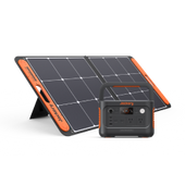
• First, this article starts with the historical data on cyclones in Queensland and introduces the definition of cyclones. • These deep troughs can cause severe flooding. An example was the 2019 Townsville and Northwest Queensland floods, where over 2.5 meters (2500mm) of rain fell over approximately 10 days in some places. • Intense Tropical Cyclone Jasper was the most precipitation-laden tropical cyclone in Australian history, exceeding Cyclone Peter in 1979. • In addition, another core content introduces the preparations that ordinary residents should make before, during, and after the cyclone. • We recommend Jackery Explorer 2000 Plus and 1000 Plus to charge the essential electronics and devices for your hike, such as your phone, radio, GPS device, and more. |
Queensland Cyclone Overview
Tropical cyclones are usually low-pressure systems that form over warm, tropical waters. This definition makes them sound almost harmless. But as anyone who has experienced a cyclone knows, it's far from the case. They're violent, spiralling wind and rain systems that can wreak havoc at sea and on land. They cause extensive flooding, foreshore erosion, wind damage, and loss of property and life.
Due to the Earth's rotation, a cluster of thunderstorms can start rotating around a common centre over warm tropical oceans. If the conditions are right, this process can sustain itself and create a tropical cyclone. The tropical storm is like a giant atmospheric heat engine at this stage.
The moisture from the warm oceans is its fuel, generating vast amounts of energy. The rotating thunderstorms form spiral rainbands. Their clouds, circling the cyclone's circular eye (centre) where the strongest winds are found, transport heat 15 km or higher into the atmosphere. There, drier, cooler air becomes the exhaust gas of the heat engine.
Some of this cool air sinks into the low-pressure region at the centre of the cyclone—the relatively calm eye. The eye is usually about 40 km wide but can range from ten to over 100 km, with light winds and often clear skies. The rest of the cool air spirals outward, away from the cyclone centre, sinking in the regions between the rainbands. As long as the environmental conditions support this atmospheric heat engine, the tropical cyclone can maintain its structure and even intensify.

(Data Source: Queensland Fire and Emergency Services)
Cyclones in Queensland Facts
Tropical cyclones are often associated with a deep monsoon trough, an elongated area of low pressure extending from the hurricane. These deep troughs can cause severe flooding. An example was the 2019 Townsville and Northwest Queensland floods, where over 2.5 meters (2500mm) of rain fell over approximately 10 days in some places.
Tropical cyclones are less common in the far south of Queensland due to lower sea surface temperatures and high-pressure ridges that commonly form. High-pressure ridges are the opposite of low-pressure troughs and are elongated areas of high pressure extending outward from high-pressure systems. As low-pressure and high-pressure systems cannot interact, they often repel cyclones away from the southern Queensland coast.
One hundred years ago, two of the deadliest cyclones recorded in Australian history struck north Queensland within months of each other. On January 21, the Mackay Cyclone devastated Mackay and the surrounding area. Less than two months later, on March 10, an even stronger cyclone hurled into Innisfail. In addition to the State Library of Queensland images already documenting these cyclones, several newly digitised images from the collection further bring to life the destruction of these events.
In 2023, the intense Tropical Cyclone Jasper was the most precipitation-laden tropical cyclone in Australian history, exceeding Cyclone Peter in 1979. The third disturbance of the 2023–24 South Pacific cyclone season and the inaugural named storm and severe tropical cyclone of the 2023–24 Australian region cyclone season, Jasper was initially identified as an area of low pressure in the South Pacific Ocean, which developed slowly while moving south-west through Fiji's area of responsibility.
The storm began to consolidate as it approached the Australian region, prompting the Australian Bureau of Meteorology (BoM) to classify it as a Category 1 tropical cyclone on the Australian scale and designate Jasper. On December 7, the storm rapidly escalated to a Category 5 tropical cyclone, with the Joint Typhoon Warning Centre (JTWC) estimating sustained winds of 220 km/h (140 mph).
If you want to read the detailed post-cyclone reports for Australian cyclones dating back to 1970, you can visit the official website. Besides, for more climate projection data and services and the history data of cyclones for Queensland, you can visit Queensland future climate.
How Do You Prepare for A Cyclone in Queensland?
While most cyclones tend to impact Northern Queensland, South East Queensland is not exempt. Cyclone season is from November through April. If you live in South East Queensland, Brisbane, and the surrounding areas, you should be well-prepared before the season arrives.

Step 1: Keep Informed about Cyclone
Please update your local radio and TV stations to listen for warnings, weather updates, and local community safety announcements. You can also check the Bureau of Meteorology for weather warnings.
Learn the Queensland Disaster Management home page for information on disaster events. To your Council website for local information on the emergency, evacuation centres and routes, and assistance after a disaster event.
The warning system advises when and what action should be taken. In a forecast cyclone, it is best to stay informed, follow the alerts and warnings issued by Emergency WA, and listen to the local ABC radio station.
Stay connected to your local ABC Radio station on a battery-powered radio, and check the ABC Emergency Twitter and Facebook pages frequently for cyclone instructions and updates, as its route can alter suddenly.
|
Warnings |
|
|
Cyclone Watch |
A cyclone watch is issued at six (6) hourly intervals when a cyclone or possible cyclone is present and gale-force winds or stronger are expected to strike coastal or island populations over the next 24 to 48 hours. |
|
Cyclone Warning |
A cyclone warning is issued three (3) times per hour if gale-force winds or stronger are predicted to strike coastal or island populations within 24 hours. When a storm approaches landfall, warnings are updated hourly. Specific cyclone alerts may include the Standard Emergency Warning Signal (SEWS). |
|
Severe Weather Warning |
A severe weather warning may be issued if the storm is no longer a cyclone but still poses a hazard to populations with damaging winds, torrential rains, or pounding surf. |
(Data Source: Disaster QLD)
Step 2: Make an Emergency Plan
Firstly, research natural disaster management in your area. If severe storms, cyclones, floods, storm surges, or tsunamis are predicted in your area, contact your local council. Review your community's emergency plans, evacuation routes, and zones. Determine what aid is available from your local municipality and other support organisations. You can also prepare by downloading the cyclone emergency plan PDF.
Download Cyclone Emergency Plan PDF >>
Next, assess your evacuation and shelter options. If you live in a well-built home outside a storm-tide or flood-prone area, prepare to shelter in place. Choose the safest area of your home to seek sanctuary. How long can you stay alone if you seek refuge in your home? How many days of supplies would you need?
Know where the nearest evacuation centres are. Should you be asked to evacuate your home, being familiar with the location and best routes to an evacuation centre will help keep you calm in an emergency.
Ensure that everyone in your household knows the safest place to be in a cyclone. If you aren't evacuated, you must be in the most substantial part of your house. Teach everyone in the family how to turn off the gas, power and water. Everything should be turned off before evacuating and sometimes when staying home to ride out the storm.
Step 3: Pack the Emergency Kit
Another strategy for preparing for a cyclone in Queensland is to put together an emergency kit. An emergency pack includes essential items for surviving disasters, including hurricanes, floods, and storms. If you lose power or water, your kit should have enough supplies to last several days.
Make sure there are adequate supplies for everyone in your household. Store your materials in a waterproof container that is easy to access. Check your kit every season to ensure the contents are fresh and safe. Create your kit right away:
|
Cyclone QLD Emergency Kit Checklist |
||
|
Water (10 litres per person) |
Non-perished Food (3 Days) |
Can Opener |
|
Plates |
Cutlery |
Torch |
|
Phone Charger |
Cable |
Radio |
|
Portable Stove |
Kitchen Utensils |
Pans |
|
Jackery Solar Generator |
First Aid Kit |
Medications |
|
Clothes |
Sturdy Gloves |
Toilet Paper |
|
Face Masks |
Toothpaste & Brush |
Wet Wipes |
|
ID Cards |
Cash |
Essential Certificates |
|
Important Documents |
USB |
Pet Supplies |
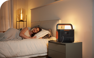
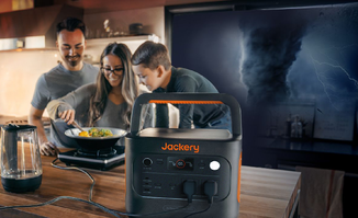
A portable power station is essential during a cyclone as it offers an immediate source of electricity when the power grid fails. This enables access to vital appliances such as medical equipment, lighting, communication devices, and basic necessities, particularly in scenarios where evacuation or power restoration may be postponed due to the storm's intensity.
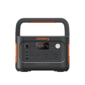
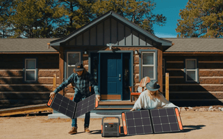
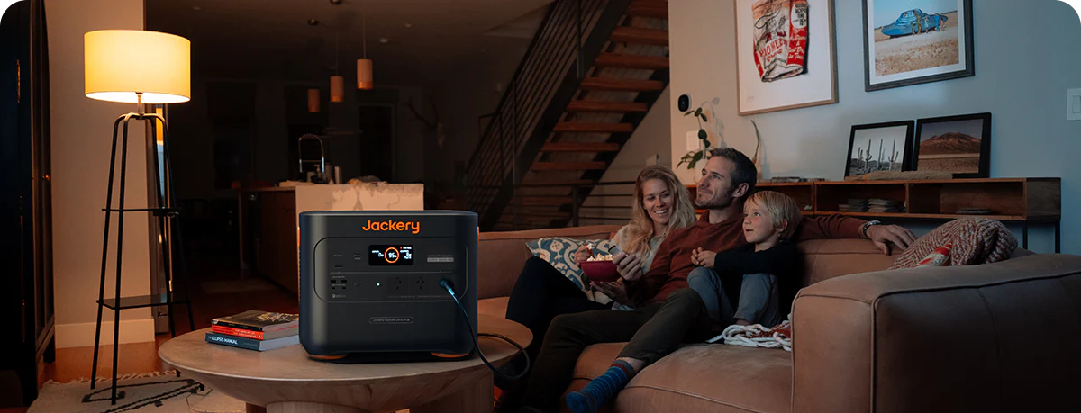
The Jackery Portable Power Station is easy to use, lightweight, and makes no noise. It has AC outlets, USB ports, and a 12V DC carport output, letting you charge several devices concurrently. The section below provides more information on Jackery Portable Power Stations.

Step 4: Cyclone Proof Home
To prevent cyclone damage to your property, improve vulnerable areas and identify potential threats in your neighbourhood. Key sections include doors, roof and windows, roof eaves, garage doors, and building attachments. A building professional will assess the wind loads on your property using Australian Standards, resulting in wind pressures or wind classifications appropriate for your area.
Before cyclone season, ensure the land around your home is free from materials that can be picked up and blown away during high winds. Debris, such as branches, metal scraps, small boats, and even children's toys, have the potential to cause damage to your home or harm to someone nearby.
Step before the season to ensure your home is built to cyclone standards. If you have any concerns, it is best to make the necessary repairs well before the season arrives. Board up your windows in the event of a cyclone warning. Be sure you always have the materials needed on hand.
Dead and dying trees should be removed from your property before cyclone season. Weak trees are not likely to withstand the storms. It's a good idea to keep full petrol tanks in your vehicles when there's a threat of bad storms in the area.
For more information about tropical cyclones, visit the Tropical Cyclone Knowledge Centre. For the latest tropical cyclone warnings and advice, visit www.bom.gov.au/cyclone.
Step 5: Prepare for Your Pet or Livestock
Remember that your dogs and cattle should also be ready for cyclones. Ensure your dogs have a recent photo, a name tag or a microchip that accurately identifies them, and maintain current cattle stock registries. Regarding pet or animal care policies in an emergency, you can also enquire about your local government.
Moving your pet to a safe place ahead of time can help safeguard them. Moving them to family and friends, animal boarding facilities, or a makeshift animal shelter or evacuation centre that welcomes animals could all fall under this category.
One should create a strategy for livestock care. Leaving early will help to guarantee their safety the most. Gates on inside fences could prevent transporting animals across public highways. Plot the gates and water sources of your property on a map. Have this map handy should someone need to move animals for you.
Jackery Portable Power Stations for Cyclone Emergencies
Cyclones often produce extensive power outages; therefore, a portable power station can supply backup electricity for important purposes when the grid fails.
During a cyclone, keeping contact with family, emergency services, and authorities is vital; a power station can run necessary communication gear. Using portable power stations, those depending on medical equipment like oxygen concentrators or ventilators can keep life support.
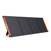
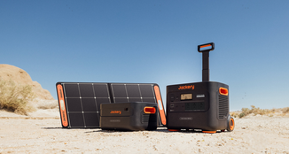
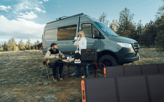
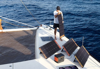
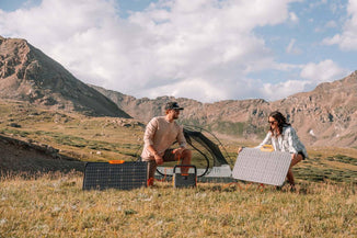
Jackery Portable Power Stations are ideal for cyclone, hurricane, and storm emergencies. They offer a stable and consistent power supply for your communication devices, medical machines, essential household appliances and electronics. You can even pair them with Jackery Solar Panels to use solar energy unlimited. If there is a long, windy, rainy day in Queensland, you can quickly recharge the power stations indoors with outlets or carports.
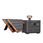
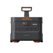
Jackery Explorer 2000 Plus
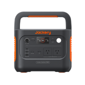
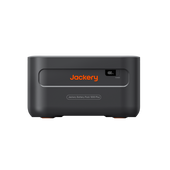
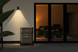
With an expandable capacity from 2 to 12 kWh, Jackery Explorer 2000 Plus is suitable for unexpected power outages caused by cyclones, hurricanes, or storms in Queensland. It can charge 99% of household appliances and electronics, such as lights, radios, phones, computers, and more. With a 20ms EPS, essential devices such as your refrigerator and CPAP remain operational instantaneously during a power outage.

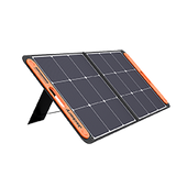
The Explorer 2000 Plus requires only 6 hours for a complete solar charge when utilising 6 SolarSaga 100W solar panels. The power source achieves complete autonomy by using solar energy for charging, eliminating reliance on the power grid. You can recharge it with a wall outlet (1.7 hours) and a carport (25 hours).
ChargeShield is Jackery's advanced quick charge technology, featuring 62 protective mechanisms, 12 protective algorithms, and four forms of physical safety protection. Manage and oversee your 2000 Plus with the Jackery App. It accommodates various devices, facilitates real-time status monitoring, and offers customisation options and additional features.
|
Jackery Explorer 2000 Plus Working Hours (2-12 kWh) |
|
|
Refrigerator (700W) |
2.5-14.6H |
|
Radio (50W) |
34.8-204H |
|
CPAP Machine (200W) |
8.7-51H |
|
Lights (100W) |
17.4-102H |
|
Kettle (800W) |
2.2-12.8H |
Review from Our User:
This was primarily purchased to handle power outages. Living on a farm means that when the power goes out, our household pressure pump stops working, resulting in water loss. This has been a problem for decades. We needed to ensure that the pumps we purchased could handle the high current draw during startup. After thorough research, I chose the 2000 Plus due to its impressive 3000w/6000w surge specification. It functions effectively. Excellent.
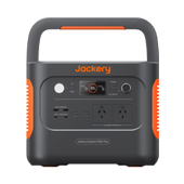
Jackery Explorer 1000 Plus
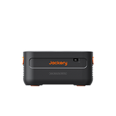
Compared to the Explorer 2000 Plus, the Jackery Explorer 1000 Plus (with 1.25 to 5 kWh expandable capacity) is more compact and inclined to use at home, off-grid cabin, or even on your boat—expandable to five power levels, offering three days of emergency backup for household use. The Jackery 1000 Plus is the premier selection for a portable power station and is adaptable for outdoor, domestic, and emergencies.

The 1000 Plus boasts a capacity of 1264 Wh and a 2000W output, the highest output among comparable items. It accommodates 99% of devices. During a cyclone in Queensland, it can charge your lights to keep your home visible, power your kettle to make clean, drinkable water, and help your medical machine work.
The Jackery 1000 Plus features a robust 10-year lifespan with a Lithium Iron Phosphate (LiFePO4) battery. It delivers a stable voltage and pure sine wave, ensuring the safety of all your electrical devices. The advanced ChargeShield technology and consistent power supply safeguard against possible equipment damage.
Utilise the state-of-the-art Advanced IBC Technology, guaranteeing an exceptionally rapid solar charge in about 4.5 hours (with 4*SolarSaga 100W). Experience unparalleled tranquillity with our silent, emission-free technology.
|
Jackery Explorer 1000 Plus Working Hours (1.25-5 kWh) |
|
|
Refrigerator (700W) |
1.5-6.1H |
|
Radio (50W) |
21.5-85H |
|
CPAP Machine (200W) |
5.4-21.3H |
|
Lights (100W) |
10.7-42.5H |
|
Kettle (800W) |
1.3-5.3H |
Review from Our User:
We relied on our Jackery 1000 Explorer Plus generator to keep the refrigerator running during a potential power outage. After experiencing three days without power due to an EF2 tornado in our city, we found it essential. A week after the storm, we operated the refrigerator on the generator during the day and turned it off at night. This approach allowed the fridge to stay cool for over 24 hours with the generator.
What Should You Do During A Cyclone in Queensland?
The following are the tips and steps to take during a cyclone in Queensland.

When a Cyclone Watch Is Issued
Re-check your property for any loose material and tie down (or fill with water) all large, relatively light items such as boats and rubbish bins.
Fill vehicles' fuel tanks. Check your emergency kit and fill water containers.
Ensure household members know which part of the house is the strongest and what to do in the event of a cyclone warning or an evacuation.
Tune in to your local radio/TV for further information and warnings.
Check that neighbours are aware of the situation and are preparing.
When a Cyclone Warning Is Issued
Depending on official advice provided by your local authorities as the cyclone in Queensland evolves, the following actions may be warranted.
If local authorities request, collect children from school or childcare centre and go home.
Park vehicles under solid shelter (hand brake on and in gear).
Put wooden or plastic outdoor furniture with other loose items in your pool or inside.
Close shutters or board up or heavily tape all windows. Draw curtains and lock doors.
Pack an evacuation kit of warm clothes, essential medications, baby formula, nappies, valuables, important papers, photos, and mementos in waterproof bags to take with your emergency kit. Large/heavy valuables could be protected in a substantial cupboard.
Remain indoors (with your pets). Stay tuned to your local radio/TV for further information.
On Warning of Local Evacuation
Evacuation may be necessary based on predicted wind speeds and storm surge heights. Official advice will be given on local radio/TV regarding safe routes and when to move.
Wear strong shoes (not thongs) and rugged clothing for protection.
Lock doors; turn off power, gas, and water; take your evacuation and emergency kits.
If evacuating inland (out of town), take pets and leave early to avoid heavy traffic, flooding and wind hazards.
If evacuating to a public shelter or higher location, follow police and State/Territory Emergency Services directions.
If going to a public shelter, take bedding needs and books or games for children.
Leave pets protected and with food and water.
When the Cyclone Strikes
Disconnect all electrical appliances. Listen to your battery radio for updates.
Stay inside and shelter (well clear of windows) in the most substantial part of the building, such as the cellar, internal hallway, or bathroom. Keep evacuation and emergency kits with you.
If the building starts to break up, protect yourself with mattresses, rugs, or blankets under a strong table or bench or hold onto a solid fixture, such as a water pipe.
Beware the calm' eye .' If the wind drops, don't assume the cyclone is over; violent winds will soon resume from another direction. Wait for the official' all clear.'
If driving, stop (handbrake on and in gear) — but well away from the sea and clear of trees,
power lines and streams. Stay in the vehicle.
The Queensland Government has a range of information and advice for preparing for disasters, including how to prepare your emergency plan and prepare your home.
What Should You Do After A Cyclone in Queensland?
After the Queensland cyclone has swept through your area, safely navigating the aftermath is as critical as the initial preparation. Even when the winds have calmed, the danger isn't necessarily over. The following steps will guide you through the immediate actions to take once the threat has passed, ensuring the safety of your home and family.
Listen to Local Authorities: Tune in to local news for vital safety information. Follow all instructions from emergency services, including whether it's safe to return home if you've evacuated.
Inspect Your Home: If it's safe, carefully inspect your home for damage. Watch for hazards like loose power lines, gas leaks, and structural damage. If you suspect any utilities are damaged, immediately turn them off at the main switch.
Document Damage: Take photos or videos of your property's damage for insurance purposes. However, prioritise safety over quick completion of the documentation process, and don't take any risks to capture this information.
Check-In with Others: Contact family, friends, and neighbours to inform them of your safety and check their well-being. Use text messages, social media, or community safety check-in services to conserve your phone's battery life and manage your power requirements carefully.
Use Safe Water: Rely on your emergency water supply or boil tap water before drinking until official announcements declare the water supply is safe from contaminants.
Avoid Floodwaters: Don't walk, swim, or dive through floodwaters. They could be electrically charged from downed power lines or contain hazardous debris that could cause serious injury and increase the risk of infections.
Begin Clean-Up Safely: Once it's safe, start clean-up efforts, wearing protective gear like gloves, boots, and masks to prevent injury or illness from debris or contaminated water.
Reach Out for Help: If you need assistance, contact local disaster relief services. They can provide aid in various ways, including supplying basic supplies, shelter, and other emergency resources.
Cyclone Queensland FAQs
The following are the frequently asked questions about the cyclone in Queensland.
1. Why are warm sea surface temperatures essential for tropical cyclone development?
Moisture from the ocean is the cyclone's fuel. The moisture that evaporates from the sea surface rises into the atmosphere. As it condenses back into liquid water, it releases energy. As sea surface temperatures get warmer, more energy becomes available. So warm sea surface temperatures are essential for developing and sustaining tropical cyclones so they don't run out of fuel.
2. What's the difference between tropical cyclones, hurricanes, and typhoons?
The tropical cyclone season in Australia is officially between November 1 and April 30, with most cyclones occurring from January to March. Hurricanes and typhoons typically develop at different times of the year. The Atlantic hurricane season runs from June 1 to November 30, and the Eastern Pacific hurricane season runs from May 15 to November 30. Most typhoons form from May to October, although they can occur year-round.
3. How many tropical cyclones does Australia typically see per year?
Australia experiences an average of 11 cyclones yearly, with 4 crossing our coast. However, only one cyclone can have a devastating effect on communities.
Final Thoughts
Every year, between November and April, the coastal regions of Queensland are at risk of being hit by cyclones. A cyclone is a violent storm characterised by high winds rotating around a calm centre that can produce winds over 200 km/h. These strong winds can cause extensive damage to property and turn debris into dangerous missiles. However, if we prepare for hurricanes in advance and have adequate measures to deal with them, we can all get through this period safely.

